FAILED MILITARY ATTEMPT TO SHOOT DOWN UNDISCLOSED ADDITIONAL CHINESE SPY BALLOON OVER THE SKIES OF OHIO WAS CAUSE OF TOXIC EAST PALESTINE TRAIN DERAILMENT OF FEBRUARY 3, 2023
January 22, 2026, update: PROOF POSITIVE OF A COVER-UP: NTSB Photographic Evidence Illegally Altered
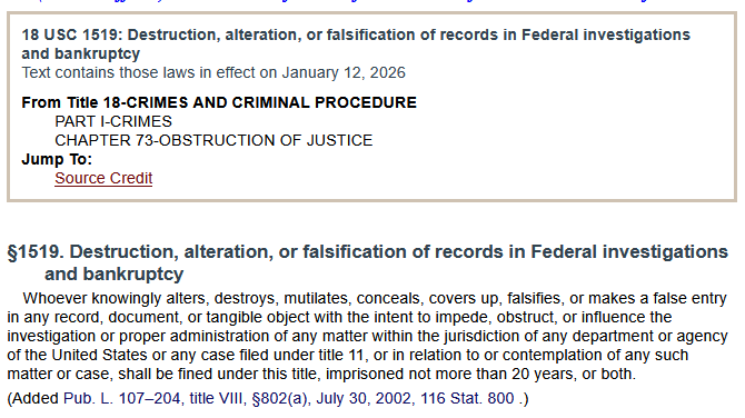
It doesn’t take a Rocket Scientist to understand that there is only one rational explanation for risking 20 years in a Federal Prison plus a $100,000 fine by illegally altering evidence in the National Transportation Safety Board’s investigation of the train derailment in East Palestine, Ohio, on February 3, 2023, and that is that there was something very damning that the powers to be wanted to keep secret.
This illegal evidence tampering comes in the form of a digital photograph that was taken of the Pressure Release Device (PRD) of NS32 Train Car OCPX80235, which was the second car carrying the toxic vinyl chloride that was intentionally detonated and burned three days after the initial derailment. The tampered evidence is found in the NTSB’s official evidence public vault at: https://data.ntsb.gov/Docket/Document/docBLOB?ID=15618213&FileExtension=pdf&FileName=Group%20D%20-%20Exhibit%2048%20-%20Hazmat%20Factual%20Report%20Figure%2041-Rel.pdf
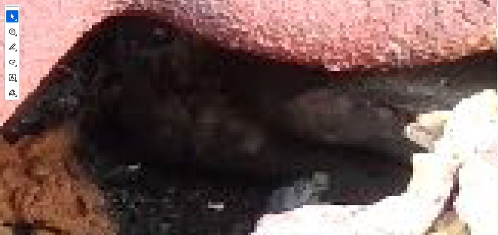
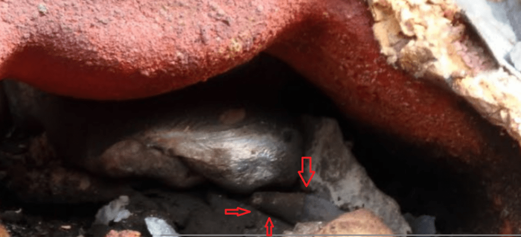
By opening this file in a program as simple as Adobe Reader and zooming in by about 1600x it is obvious that a blur was intentionally added over a particular object. In fact, the object that was blurred out was actually bagged and tagged BEFORE the vent and burn procedure and later chemically analyzed in a laboratory a couple of weeks later. The sharp straight lines in the photo are indicative of a photoshopped image.
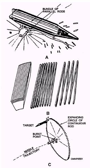
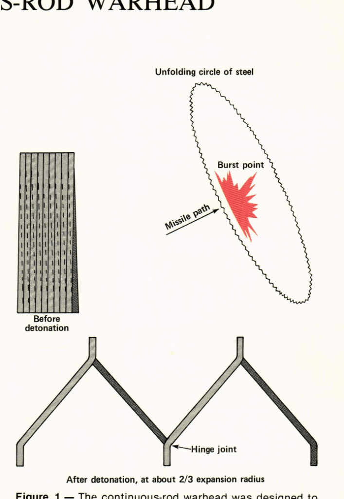
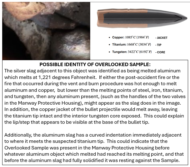
Below is the object that was intentionally blurred out in the photo above. The orange arrow on this NTSB Evidentiary Image, which was added by this author, points to a folded over area of the laboratory sample. To this author it has a striking similarity to a TITANIUM rod from an annular blast ring of the warhead of a Sidewinder Missile. A Sidewinder Missile was deployed the afternoon after the derailment to shoot down an acknowledged Chinese Spy Balloon off the coast of South Carolina.
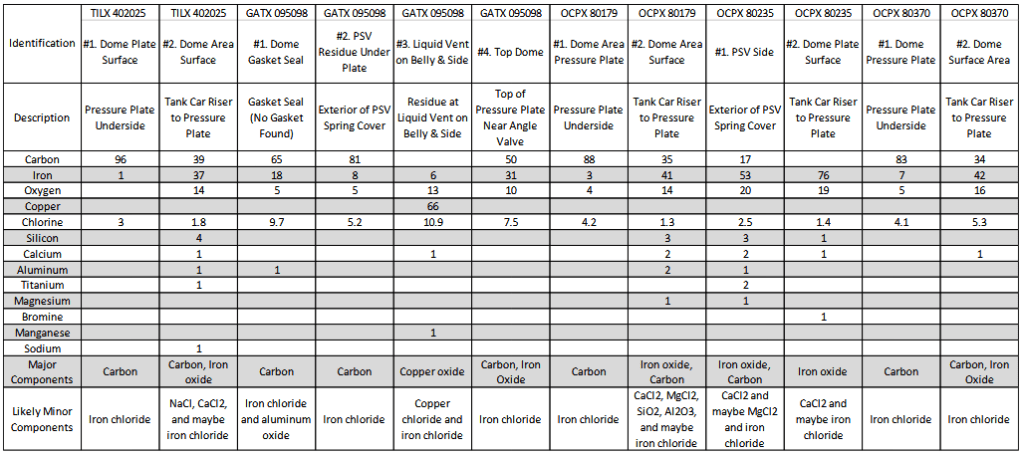
Below are the lab results of all the samples that NTSB tested. It should be noted though that other evidence was gathered by Norfolk Southern who attempted to turn it over to the NTSB, but was in turn repeatedly told that they did not want it because it was against THEIR protocol to consider evidence that was not personally collected by THEIR agency. Sounds like a cover-up to me!
December 2025 update:
It’s here! “FAILED ATTEMPT TO SHOOT DOWN UNDISCLOSED SPY BALLOON CAUSED EAST PALESTINE TRAIN DERAILMENT – Part I – Silent Running”
There is not any sound on this video so that you can concentrate on the images and not what I or anyone else thinks about them. Then after watching them let us hear your thoughts or ideas. Thanks!
[Best viewed at 720 or 1080 download resolution
DECEMBER 6, 2025 UPDATE
The BLACK spot on this image is directly over Train NS32 a couple of minutes before the derailment, and is almost centered on the Hot Box Detector that registered the 250+ degree overheated wheel bearing. This NEXRAD Radar Product indicates that the target that the radar was picking up was substantially taller than it was wide. The interesting thing, though, is that that object is about 2,623 feet above the ground so it couldn’t be smoke or dust from the train, (which would not arrive at that location for 2 more minutes!). Images like this are also known to be indicative of strong updrafts or downdrafts, (perhaps caused from large fast moving projectiles?).
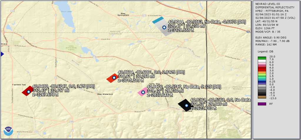
The satellite and radar images are timestamped in Greenwich Mean Time (GMT or Z). This equates to a timestamp of 02/04/2023 01:51:16 Z being February 3, 2023, at 8:51 p.m. The train derailed on February 3, 2023, at 8:52 p.m approximately 1/2 mile past the BLACK Radar Target.
NOVEMBER 25, 2025 UPDATE
Newly discovered evidence indicates that the train derailment was not merely the result of a failed wheel bearing.
The image below displays a peculiar Radar Target at Alliance, Ohio, directly over the railroad tracks at the exact time that Train NS32 was traversing it.

{Moving on to more “Conspiracy Theories”}
Is Google Earth Complicit in the Disappearance of Fort Knox Gold Bullion?
Is this what the TESLA TRUCK “Bomber” was talking about?
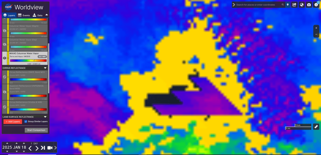
MAIAC Columnar Water Vapor measures the total amount of water vapor in vertical column of air; it provides the measurement of total water vapor content above a given land area. Can this be used to identify cloaked Drone Motherships.
Both halves of this image are at the same zoom level
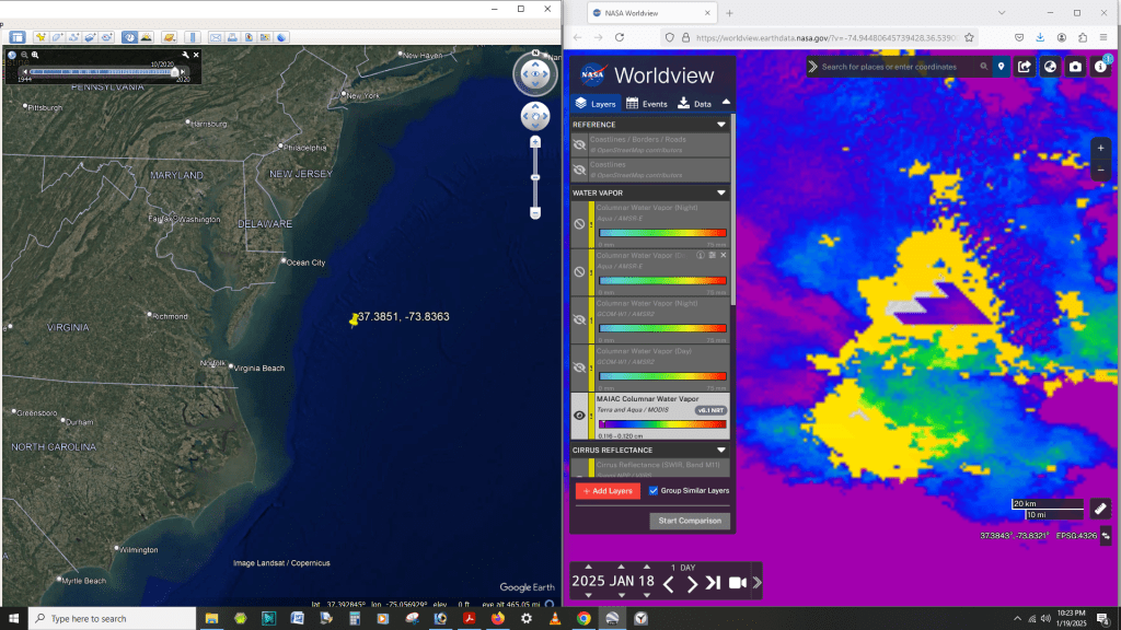
This Object is “Independence Day” Huge !

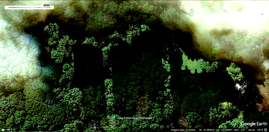
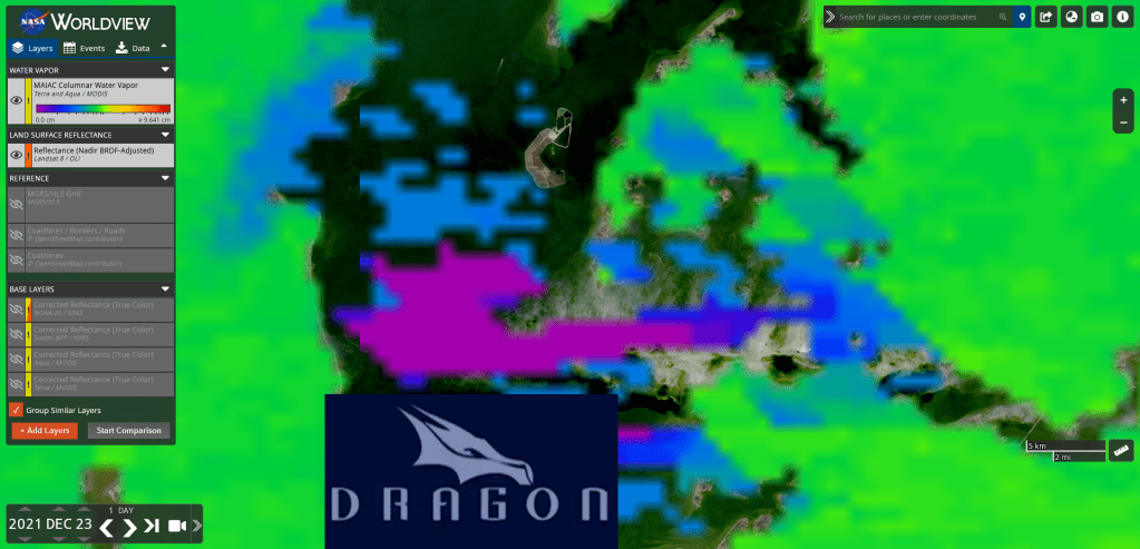
Below is Another Example of De-Cloaking Capabilities


Trending